Dhaka – A drone devised by a group of young Bangladeshi scientists has successfully mapped environmental damage caused by a tanker spilling furnace oil into the Shela River in the ecologically sensitive Sunderbans region.
On 9 December 2014, the tanker capsized spilling 350,000 litres of oil into the river in south Bagerhat district, posing a threat to the Sunderbans, a World Heritage site spread over 1,000 square kilometres, a third of it falling in neighbouring India.
“Our goal was to conduct aerial mapping of the oil spill, obtain the density of the oil in the river waters and obtain digital images to go into a comprehensive report on the disaster,” team leader of the drone mission Syed Razwanul Haque, scientist at the Shahjalal University of Science and Technology, Sylhet, tells SciDev.Net.
Haque’s team deployed the quadcopter — an unmanned mini-helicopter with four rotors and equipped with a camera — to map the damage in the difficult mangrove-forested terrain, famous as the home of the Royal Bengal Tiger and rare freshwater dolphins.
The 0.20 square metre drone takes off and lands on its own and is powered by lithium batteries that can keep it airborne for 25 minutes at a time. For the Sunderbans mission, the drone was based on a boat moving along the jagged coast to enhance range.
Shams Jaber, a team member of the project, said the biggest challenge flying the drone was air turbulence and extremely windy conditions. Although the final report is yet to be released, the drone detected oil slick spreading 300—400 kilometres into the sea with substantial damage caused to forests and aquatic life.
“Our mission succeeded in obtaining first-hand information of the devastation that was sufficient for an initial assessment,” Haque tellsSciDev.Net.
The current model costs around US$ 2,500. An improved version with longer-lasting batteries and better sensors would cost about US$ 18,500 but the data quality would not be too far different, Haque says.
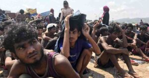
Similar drones could easily find application in monitoring traffic, emergency relief operations, anti-crime patrols and the prevention of human trafficking in remote border areas, Haque adds.
This article has been produced by SciDev.Net’s South Asia desk.