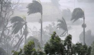
Thousands of Scottish homes are without power as a “weather bomb” storm hits western coastal areas.Electricity has been cut across the Western Isles, affecting 17,000 homes, and there is other disruption including train and ferry
cancellations. The Met Office has warned parts of Scotland and Northern Ireland to “be prepared” as the rapidly developing storm threatens gusts of up to 80mph. Conditions off Scotland were “pretty bad” by 06:30 GMT, a lifeboatman said. Speaking from Barra in the Outer Hebrides, Donald MacLeod, coxswain of the island’s lifeboat, said there was rain, hail and “plenty of wind”. ‘Wild’ weather
He said the storm had “grown through the night”, adding: “The swell conditions are pretty bad to the west – it’s showing about 14m
(45ft).” Mr Macleod said this was “a lot deeper than we normally see” and was “definitely something to be wary of”. BBC weather presenter Carol Kirkwood said it would be a “wild” day from north Wales northwards, while it would be “blustery” further south. She said the winds would peak in the afternoon and early evening. Power supplier SSE said the problem affecting the Western Isles was caused by lightning, and homes should be reconnected during the morning. Western Isles Council said all schools would be closed, along with many other facilities. In Aberdeenshire, about 20 vehicles are stuck in icy conditions on the B974 Banchory to Fettercairn road. Ahead of the forecast storms, ferry operator Caledonian MacBrayne warned of severe disruption to its services. In other developments: • Irish Ferries cancelled some services between Holyhead and Dublin • Stornoway Coastguard said the sea state could become “phenomenal”, a term used to describe the worst conditions • Scottish and Southern Energy said it had gone on yellow alertwhich means it was anticipating power cuts • Northern Ireland Electricity warned of a possibility of damage to the electricity network in exposed areas, with its emergency crews and engineers put on standby • The Scottish Environment Protection Agency has more than 25 flood warnings and alerts in place, many in coastal areas Explosive cyclogenesis – known colloquially as a “weather bomb” – is when a storm intensifies as the pressure at its centre drops rapidly (by more than 24 millibars in 24 hours). The Met Office’s amber “be prepared” warning is in effect for the Northern Isles, Western Isles – where all schools and nurseries will be closed – the north and west Highlands and Argyll, as well as the far north of Northern Ireland. There is also a less-severe yellow warning covering the rest of Scotland and Northern Ireland, as well as north Wales and northern England. Numerous flood warnings and alerts have also been issued, mostly in Scotland. Gusts of more than 60mph (95km/h) have been recorded in Northern Ireland, where the speed limit on the Foyle Bridge in Derry has been reduced to 30mph. A second storm front is expected to track across the country overnight on Thursday, the Met Office said. It said there could be gales and a band of heavy rain across much of England and Wales during the first half of Friday, which could then push eastwards before easing in the early afternoon.Weather information Surf forecast Magicseaweed.com produced a chart predicting the movement of swells from 06:00 to 15:00 Network Rail said the services already cancelled in Scotland were those most likely to be exposed to the predicted winds and high tides expected later. They are the services between Inverness-Kyle/Thurso/Wick, Ayr-Stranraer, Kilwinning-Ardrossan/Largs and Dumbarton Central-Helensburgh Central. The Glasgow Queen St-Oban/Fort William/Mallaig line, including the Caledonian Sleeper is also affected. The company said replacement bus services would be considered, but these were dependent on road conditions. ScotRail said services had started “quite well” on Wednesday morning. But operations and safety director Jacqueline Dey said: “We have had a number of lightning strikes, which has caused some disruption on the Edinburgh-Glasgow Central via Shotts line and the Perth area.” A CalMac ferry spokesman said severe weather along the west coast on Tuesday had caused “extensive disruption” to its services, with further cancellations expected. Richard Brown, of the Scottish Environment Protection Agency, said
Caithness, Sutherland, the Western Isles, Orkney and Shetland were at the greatest risk of coastal flooding as the storm front hit.
Argyll and Bute, the Firth of Clyde, Clyde estuary and Dumfries and Galloway could also be affected, he said. -BBC


