May 17, 2018 SANDRP
Massive human induced freshwater redistribution with profound consequences. A 14-year (April 2002 – March 2016) NASA’s GRACE (Gravity Recovery and Climate Experiment) mission has confirmed that a massive redistribution of freshwater is occurring across Earth, with middle-latitude belts drying and the tropics and higher latitudes gaining water supplies. The results, which are probably a combination of the effects of climate change, vast human withdrawals of groundwater, Dams and natural changes, could have profound consequences if they continue. The paper is the first to use gravitational satellite data to map global trends in fresh water availability across a 14-year period. The research identifies 34 areas where water resources rose or fell significantly during the period. “The largest changes we see anywhere are the ice sheet and glacier losses, those are the fastest rates of change. But that is not typically water you would use for drinking or agriculture,” says Matthew Rodell, the lead author on the report and a hydrologist at Nasa.
Broader observations The results emerge from the 2002-2016 GRACE mission, supplemented with additional data sources. The GRACE mission, which recently ended but will soon be replaced by a “GRACE Follow-On” endeavor (Scheduled to be launched from California on May 22, 2018), consisted of twin satellites in orbit that detected the tug of Earth’s gravity below them — and monitored mass changes based on slight differences in measurements by the two satellites.
The new research, led by NASA’s Matthew Rodell, pulls together these findings to identify 34 global regions (they do not all have the same cause — not even close) that gained or lost more than 32 Billion Tons (BT) of water between 2002 and 2016. The resulting map of the findings shows an overall pattern, in which ice sheets and glaciers lose by far the most mass at the poles, but at the same time, middle latitudes show multiple areas of growing dryness even as higher latitudes and the tropical belt tend to see increases in water. The idea of mid-latitude drying and higher- and lower-latitude wetting is a common feature of climate change models and GRACE conclusions.
There are other human-induced changes, relating not to climate change but, rather, to direct withdrawals of water from the landscape. In northern India, the northern China plain and the Caspian and Aral seas in Central Asia, among other regions, human withdrawals for agriculture have subtracted enormous amounts of water from Earth. There are also major cases of humans increasing water storage in the landscape, particularly in China, where massive dam construction has created enormous reservoirs.
What’s striking about the map is the way that a combination of human-driven water withdrawals and droughts seem to be punishing the central latitudes of the Northern Hemisphere, in particular, but also the Southern Hemisphere to a significant extent. However, the data remains coarse and the causes behind the trends in many cases remain a matter of interpretation.
Consistent with IPCC “While the pattern of wet-getting-wetter, dry-getting-drier is predicted by the Intergovermental Panel on Climate Change models for the end of the 21st century, we can’t yet attribute the emergence of a similar pattern in the GRACE data to climate change,” Famiglietti said. “But it’s consistent with what the climate models project.”
Big changes in 34 Regions: Three categories The NASA researchers, as noted above, have identifies 34 regions where major changes have occurred. They have divided these changes in three broad categories. During the 14 years of satellite measurements, nearly all the 34 identified regions lost or gained at least 32 BT. Eleven of the regions lost or gained 10 times that or more. “The numbers are huge. It’s pretty staggering,” Rodell said. “A large portion of them, either direct or indirect human impacts were factors, if not outright the major cause.”
• They ascribed changes in 12 regions to natural variability, including a progression from a dry period to a wet period in the northern Great Plains, a drought in eastern Brazil and wetter periods in the Amazon and tropical West Africa.
• In 14 of the areas — more than 40 percent of the hotspots — the scientists associated the water shifts partially or largely with human activity. That included groundwater depletion combined with drought in Southern California and the southern High Plains from Kansas to the Texas Panhandle, as well as in the northern Middle East, northern Africa, southern Russia, Ukraine and Kazakhstan. Many of the areas where the researchers saw direct human impacts are farming regions that have relied heavily on groundwater pumping, including northern India, the North China Plain and parts of Saudi Arabia. The scientists also identified other human-driven impacts, including water diversions that have led to declines in the Caspian Sea and the construction of Three Gorges Dam and other reservoirs in China.
• The research identifies eight regions where the changes were mainly caused by climate.
Key regional analysis Some Key regional information and analysis:
• The study, published in the May 17, 2018 issue of the journal Nature said:
Groundwater, soil moisture, surface waters, snow and ice (these five components collectively form TWS: Terrestrial Water Storage) are dynamic components of the terrestrial water cycle. Although they are not static on an annual basis, in the absence of hydro-climatic shifts or substantial anthropogenic stresses they typically remain range-bound. Here they map TWS change rates around the globe based on 14 years of GRACE observations. The paper used 1979–2016 precipitation data from the Global Precipitation Climatology Project version 2.3.
• On a monthly basis GRACE can resolve TWS changes with sufficient accuracy over scales that range from approximately 200,000 km2 at low latitudes to about 90,000 km2 near the poles. However, owing to GRACE’s coarse spatial resolution, the inability to partition component mass changes and the brevity of the time series, proper attribution of the TWS changes requires comprehensive examination of all available auxiliary information and data, which has never before been performed at the global scale.
• By far the largest TWS trends occur in Antarctica (region 1; −127.6 ± 39.9 BT/yr averaged over the continent), Greenland (region 2; −279.0 ± 23.2 BT/yr), the Gulf of Alaska coast (region 3; −62.6 ± 8.2 BT/yr) and the Canadian archipelago (region 4; −74.6 ± 4.1 BT/yr). Excluding those four ice-covered regions, one of the most striking aspects of changing TWS is that freshwater seems to be accumulating in far-northern North America (region 5) and Eurasia (region 6) and in the wet tropics, whereas the greatest non-frozen-freshwater losses have occurred at mid-latitudes.
India and surrounding areas What the analysis says about India and surrounding areas?
• NORTH INDIA: The hotspot in northern India (region 7) was among the first non-polar TWS trends to be revealed by GRACE. It results from groundwater extraction to irrigate crops, including wheat and rice, in a semi-arid climate. Fifty-four per cent of the area is equipped for irrigation. We estimate the rate of TWS depletion to be 19.2 ± 1.1 BT/yr, which is within the range of GRACE-based estimates from previous studies of differently defined northern-India regions. The trend persists despite precipitation being 101% of normal (namely, the 1979–2015 GPCP annual mean for the region) during the study period, with an increasing trend of 15.8 mm/yr. The fact that extractions already exceed recharge during normal-precipitation years does not bode well for the availability of groundwater during future droughts. The contribution of Himalayan glacier mass loss to the regional trend is minor.
• The increasing trend in central and southern India (region 8; 9.4 ± 0.6 BT/yr) probably reflects natural variability of (mostly monsoon) rainfall, which was 104% of normal with an increasing rate of 3.7 mm/yr (0.4% per year).
• The negative trend that extends across East India, Bangladesh, Burma and southern China (region 13), −23.3 ± 1.9 BT/yr, may be explained by a combination of intense irrigation (25%) and a decrease in monsoon season precipitation during the study period. The total annual precipitation was well above normal from 1998 to 2001, resulting in elevated TWS. During the GRACE period, precipitation declined at a rate of −10 mm/yr (−0.7% per year), and the annual accumulations were below average from 2009 to 2015. This is the third most heavily irrigated of the study regions, so TWS decline is likely to continue, although perhaps at a slower rate, given that rainfall should normalize eventually and a 15% increase in rainfall is predicted by 2100.
• Satellite altimetry and Landsat data indicate that the majority of lakes in the Tibetan Plateau have grown in water level and extent during the 2000s owing to a combination of elevated precipitation rates and increased glacier-melt flows, which are difficult to disentangle. From 1997 to 2001 the average annual precipitation in region 10 was 160 mm/yr, well below the 2002–2015 average of 175 mm/yr.
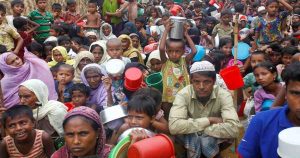
• Millions of climate refugees in South Asia? “Human security in South Asia is really at risk, in my opinion, due to decreasing water availability, due to disappearing glaciers, groundwater depletion, and changing extremes,” Famiglietti said. “The disappearance of Himalayan glaciers could result in millions of climate refugees in the coming decades.”
• Perilous path of unmanaged groundwater The NASA team said other regions including northern India, the Middle East and the area surrounding the Caspian Sea are “on a perilous path.” Famiglietti said. “But overall, groundwater continues to be undermanaged, if managed at all. And that’s why we see the rapid disappearance.”
Depleted aquifers lose their water holding capacity? After a wet winter that refilled reservoirs, California Gov. Jerry Brown declared the drought over in 2017. But the scientists said it’s “doubtful that aquifer storage will recover completely without large usage reductions.” The reason given by the NASA scientists should be worrying us in India. They said this is “in part because when aquifers are depleted the water-storing spaces between rocks, clay and sand can compact, permanently reducing how much water they hold.” This means that the aquifers depleted of water can significantly lose its water storage capacity.
In Conclusion Rodell said, “One of the important things about this map is it provides information for policymakers and decision makers to think about longer-term strategies for how we’re going to make sure that the world continues to have enough water to grow food for a growing population.” “When I sit back and look at it, I still am surprised by the human fingerprint — how strong it is, how we have really drastically altered the freshwater landscape,” said Famiglietti.
There is enough here that should worry us in India and south Asia, the authors of NASA study mince no words when they say we are on perilous path and if we do not wake up, we may be on path to making millions in South Asia as climate refugees. Unfortunately, this is already happening, its not in future.
Compiled by SANDRP (ht.sandrp@gmail.com)